Surveying house sparrows isn't like surveying other birds
In the dense and heterogenous urban environment, surveying a bird like the house sparrow that has a typical range of about 70m from the nest needs speed and precision. The problem is that we have two highly territorial species living in close proximity to each other. Sparrows, and human beings. To cover any reasonable area the census needs to be taken at walking pace or faster. Nicholas Wilkinson surveyed 500 gardens in Oxford by bicycle in 2004. Not only are there a lot of sparrow sites to cover, but the humans are going to take umbrage if strangers hang around outside their houses too long. Some of them will start to suspect you're casing the joint.
In the original 2006 Ipswich house sparrow survey, Helen and I infilled a lot of the survey areas. We used an audio recorder and a GPS, taking a waypoint with the GPS and identifying the bird and waypoint in the audio note. The advantage of this is I could automate taking in the position data, and just transcribe the bird and count. This takes typically 10 to 20 seconds in the field, about 10m at a walking pace of 5km/h. That's within the 100m precision of a six-figure grid reference.
Audio surveying
GPS audio mapping isn't a new idea, I came across it from the OpenMap community, who had largely solved this problem with audio mapping. They simply leave the recorder on capturing a stream of consciousness, because they want to capture data about the whole environment, that's what a map is. It makes the synchornisation problem easier, as they set a datum at the start of the run, doing the same job as the clapperboard in shooting a movie. The GPS track is a log of where you go, with the sections individually timestamped, which I hadn't realised. So start the recording at a datum point, and you know that the audio runs in sychronism with the GPS. Modern digital field recorders are crystal controlled to about 100ppm - about 4 seconds off in 10 hours.
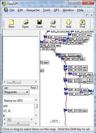
Now I don't really want to spend as much time writing up a trip as doing it, so I took a leaf from their book and used a Perl script to parse the GPX data tracklog, find the nearest section to the audio clip timestamp and create a waypoint there, with a link to the audio file in the same directory. Rather than making one massive recording, I can simply make short audio notes when I see the bird, and the Perl script will tally the record time and sort out where I am. It's easier to find a record and there is much less audio data to process.
Due to the vagaries of real-life devices you have to be able to put in an offset to take out summertime and any slight differences, but an error of 1 minute at walking speed isn't so bad for bird logging. At a steady 3mph it's about 80m uncertainty, but in practice you tend to slow down when observing birds, improving the accuracy. File timestamps do go down to the second, but keeping the clocks within a minute is a big ask. The GPS timestamp is always very accurate because it is set to an atomic clock, so it's down to setting the recorder properly. Or identifying the skew properly at the combining stage.
As an added bonus, this can work on my field recordings too, I can just save the GPX file and I know where they were made too. Using something like GPS Visualiser I can see where everytihing is on a Google map.
For bird logs, I need to open the audio and edit the waypoint names to the BTO two letter short codes of the sightings, comma separated if there are several at one point. A second run through another script expands these into the long names and creates an Excel file suitable for uploading to Birdtrack.
The app doesn't cut it
Ten years on from 2006, I did wonder if there was a better way. Nowadays, nobody will turn a hair if you start talking to a machine in public, but perhaps that was not necessary. Enter the smartphone app to the rescue, perhaps? I looked at using Birdtrack. The BTO offer a smartphone app to enter sightings directly into Birdtrack in the field (or saved locally and sent at home)
It seemed an obvious win, but when I tried the app I didn't find it that suited for surveying a single species. Each time I wanted to record a sighting I had to use the onscreen keyboard to enter "ho" to pick up house sparrow, then tap the time to acknowledge a real-time entry, and then accept the entry. It all took just too long, and I had to stop to do it. It totally pole-axed the speed that I covered ground.
There's a deeper problem - it's not what I want to get out into the field to do, to spend more time peering at an illuminated screen. Not only would Eckhart Tolle disapprove, but you also have to take your eye off the birds. Don't get me wrong, the BTO have probably done a great job with the app, and if that's how you want to list birds that's great, each to their own. It's just didn't work for me.
What totally killed the idea was that after I had uploaded the data to Birdtrack from the app, I could download the session as an Excel spreadsheet, but the position information was trucated to two digits, ie 1km squares. That is hopelessly imprecise for a sparrow census. It is fine for most bird recording, but not this application. So that was that.
An app might work - what I want is one with three big icons, a male at a nest, a male and a female. And perhaps a cancel button. The app should simply save the location and time in a file together with which button had been pressed. Unfortunately writing apps isn't a DIY job without hacking and rooting the device or paying the gatekeepers money which sets that right out. The smartphone confirms its empty promises of doing all sorts of things but none of them very well. So I returned to the audio surveying.